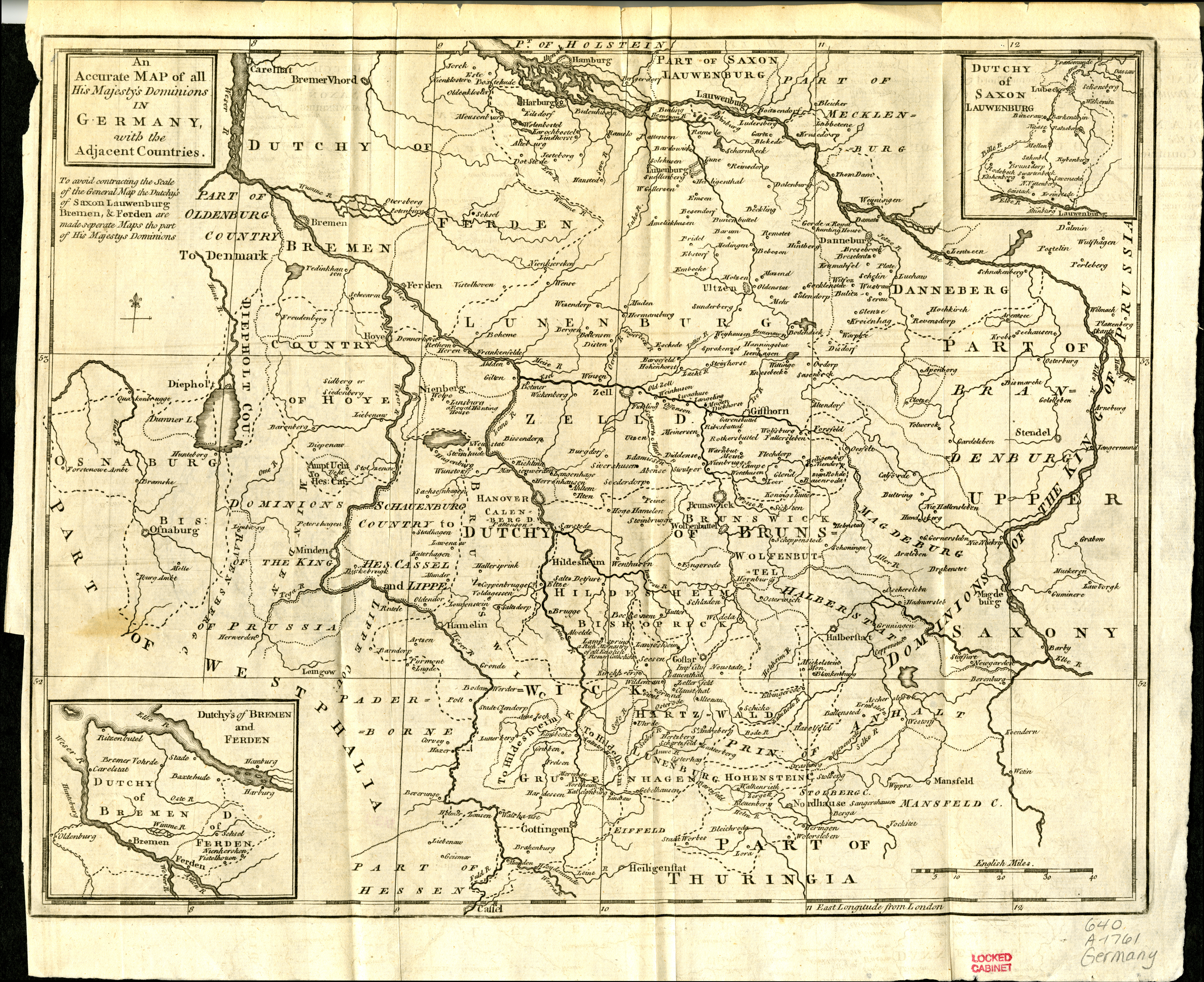
Map of northern Germany showing areas corresponding to the electorate of Hanover (also known as the electorate of Brunswick-Lüneburg). Published in the Gentlemen's magazine for January 1761. Detached from: The gentleman's magazine, and historical chronicle. Volume XXXI: for the year M.DCC.LXI. London: Printed for D. Henry [1761]. Map was originally published in the January 1761 issue, and was apparently relocated to the end of bound volumes of Volume XXXI. Prime meridian: London. Includes 2 inset maps: Dutchy of Saxon Lauwenburg [Duchy of Saxe-Lauenburg] -- Dutchy's of Bremen and Ferden [Duchies of Bremen and Verden]. Scale approximately 1:1,448,228.
