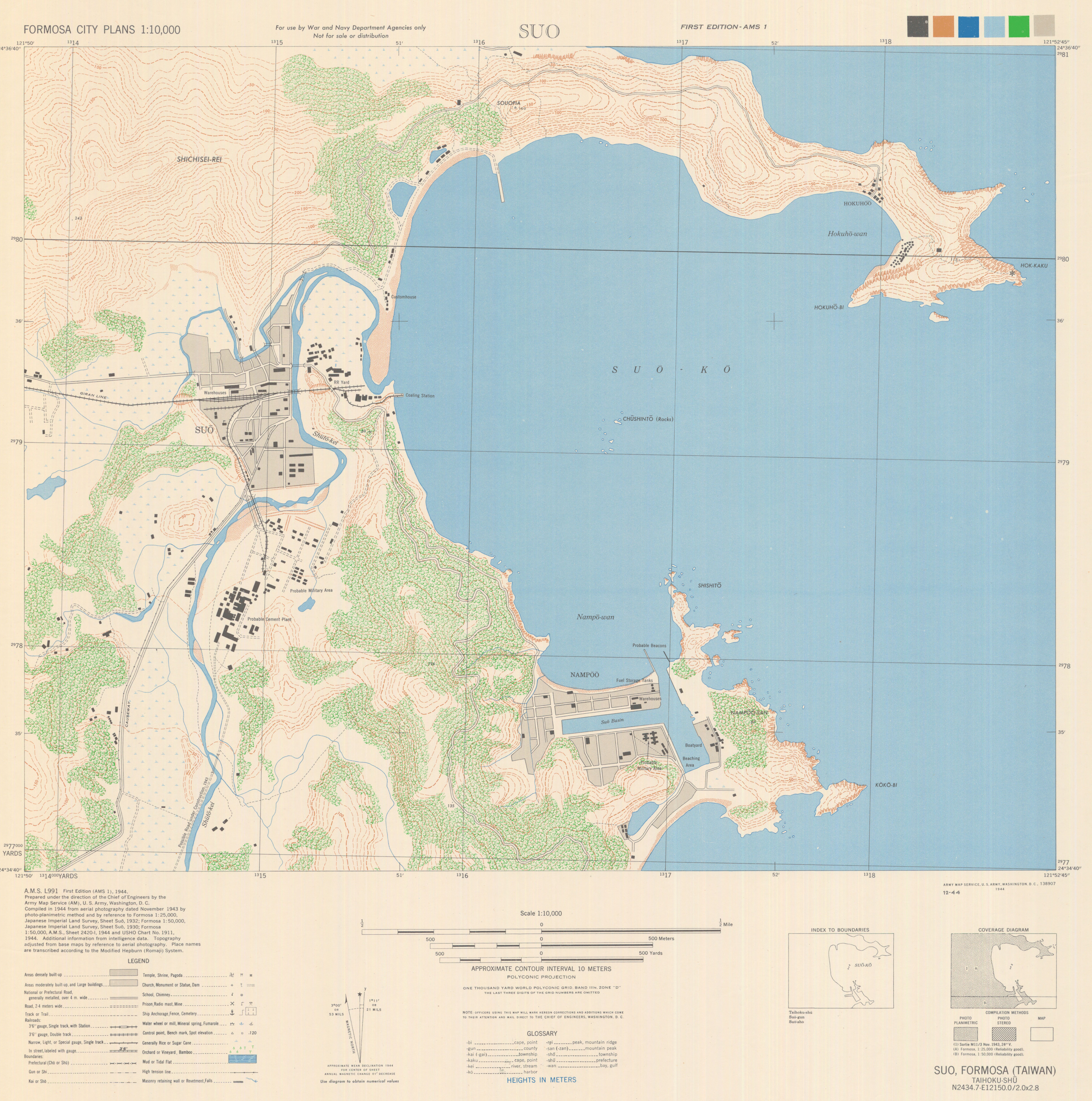
AMS 1. North Decimal Degree 24.600000. South Decimal Degree 24.583333. East Decimal Degree 121.866667. West Decimal Degree 121.833333. Alternate title: Suo. In upper left margin: Formosa city plans 1:10,000. Polyconic projection. Relief shown by 10 meter approximate contour intervals and spot elevations. Compiled in 1944 from aerial photography dated November 1943 by photo-planimetric method and by reference to Formosa 1:25,000, Japanese Imperial Land Survey, Sheet Suo, 1932; Formosa 1:50,000, Japanese Imperial Land Survey, Sheet Suo, 1930; Formosa 1:50,000, A.M.S., Sheet 2420-I, 1944 and USHO Chart No. 1911, 1944. Additional information from intelligence data. Topography adjusted from base maps by reference to aerial photography. Place names are transcribed according to the Modified Hepburn (Romaji) System. With a glossary. Name has been changed to Su-ao.
