
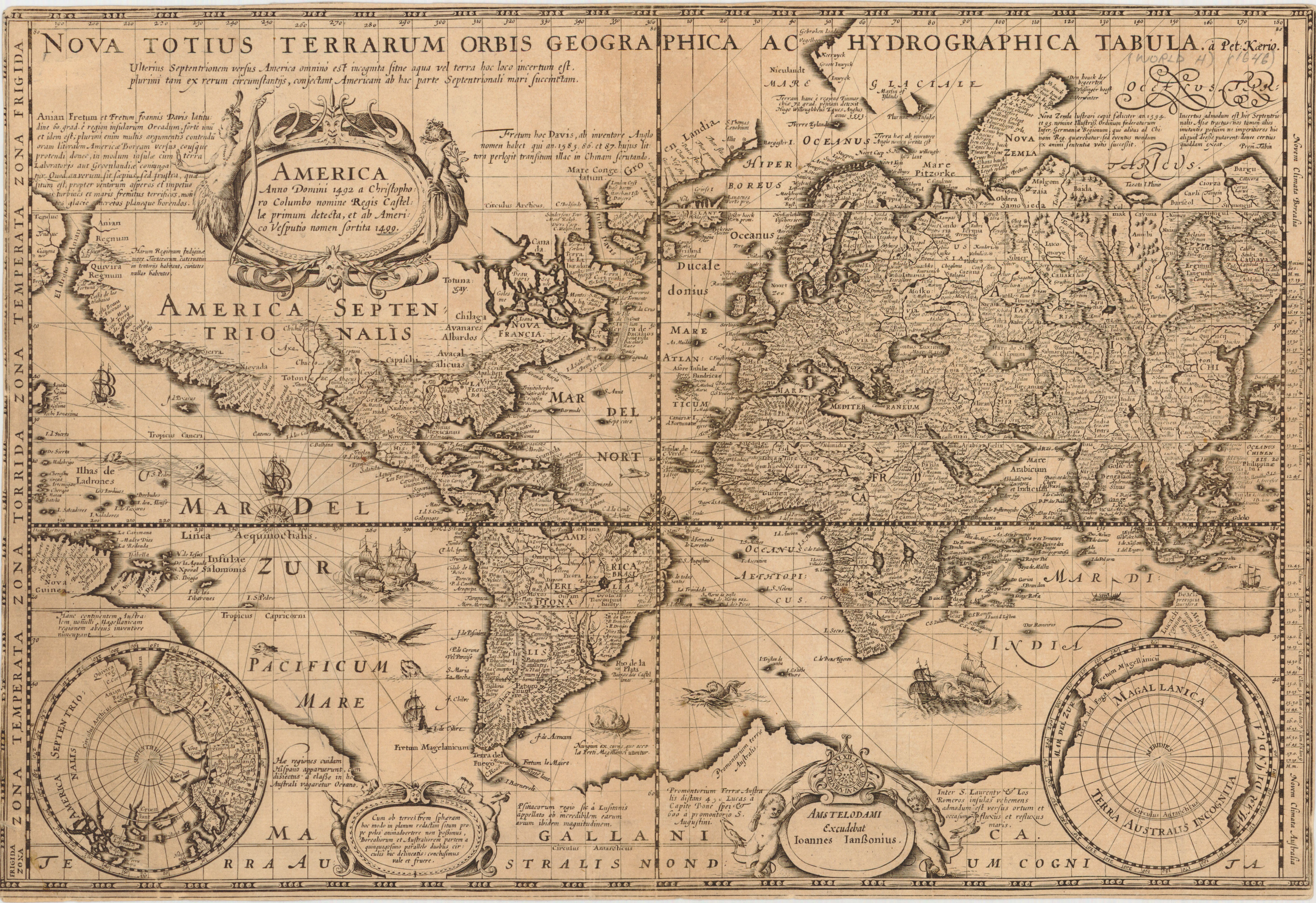
Nova totius terrarum orbis geographica ac hydrographica tabula
- Author(s):
- Keere, Pieter van den, 1571-approximately 1646
- Description:
- Relief shown pictorially. Includes inset maps of North and South Poles. The fourth state of Keere's map, without border. cf. Shirley, R. The mapping of the world, p. 283.
- Publisher:
- Amstelodami : Excudebat Ioannes Ianssonius, [1646]
- Subject(s):
- World maps—Early works to 1800
- Held by:
- Princeton
- More details at
- https://catalog.princeton.edu/catalog/4484993