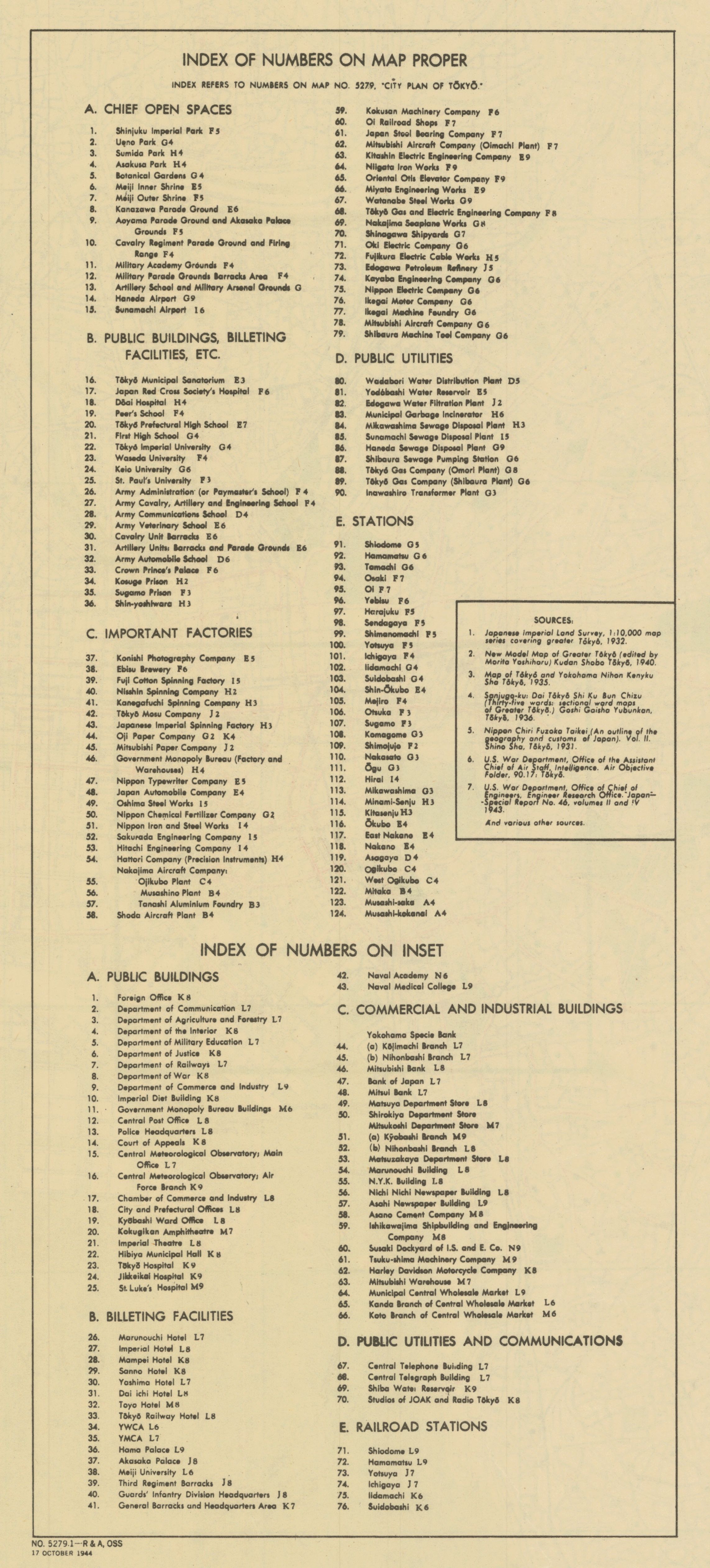
United States. Office of Strategic Services. Research and Analysis Branch. No. 5279.1 - R & A, OSS: 17 October 1944. Base map: "Map of Greater Tokyo," published by Tokyo Geographical Association, Jan. 15 1936. Reprinted by BMP no 1, GHQ. AFPAC. U.S. Army, August, 1945. Includes 5 inset maps: "Tokyo: density of population" (1:357,142), "Tokyo: functional differentiation" (1:357,142), "Tokyo: relief" (1:173,913), "Tokyo bay area" (1:1,176,470), and an enlargement of downtown Tokyo (1:28,571). On verso: "Index of numbers on map proper".
