
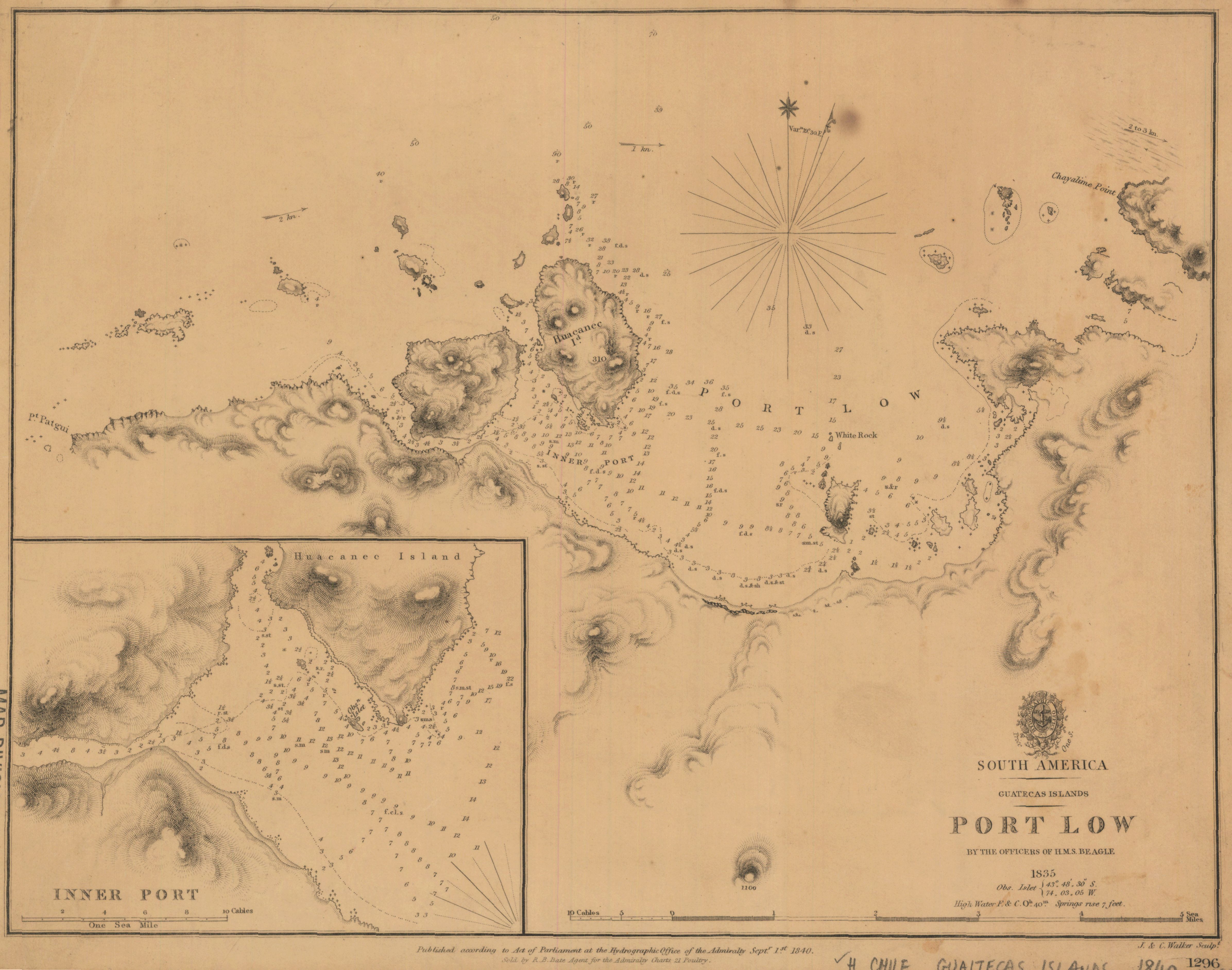
South America ; Guatecas Islands ; Port Low
- Description:
- Relief shown by hachures. Depths shown by soundings. "1296"--Lower right margin. Inset: Inner Port.
- Publisher:
- [London] : Published according to Act of Parliament at the Hydrographic Office of the Admiralty : Sold by R.B. Bate, agent for the Admiralty charts, Sept. 1st 1840.
- Place(s):
- Chile
- Subject(s):
- Nautical charts—Chile—Port Low.., Coasts—Chile—Maps, and Pacific Coast (Chile)—Maps
- Held by:
- Princeton
- More details at
- https://catalog.princeton.edu/catalog/6564436