
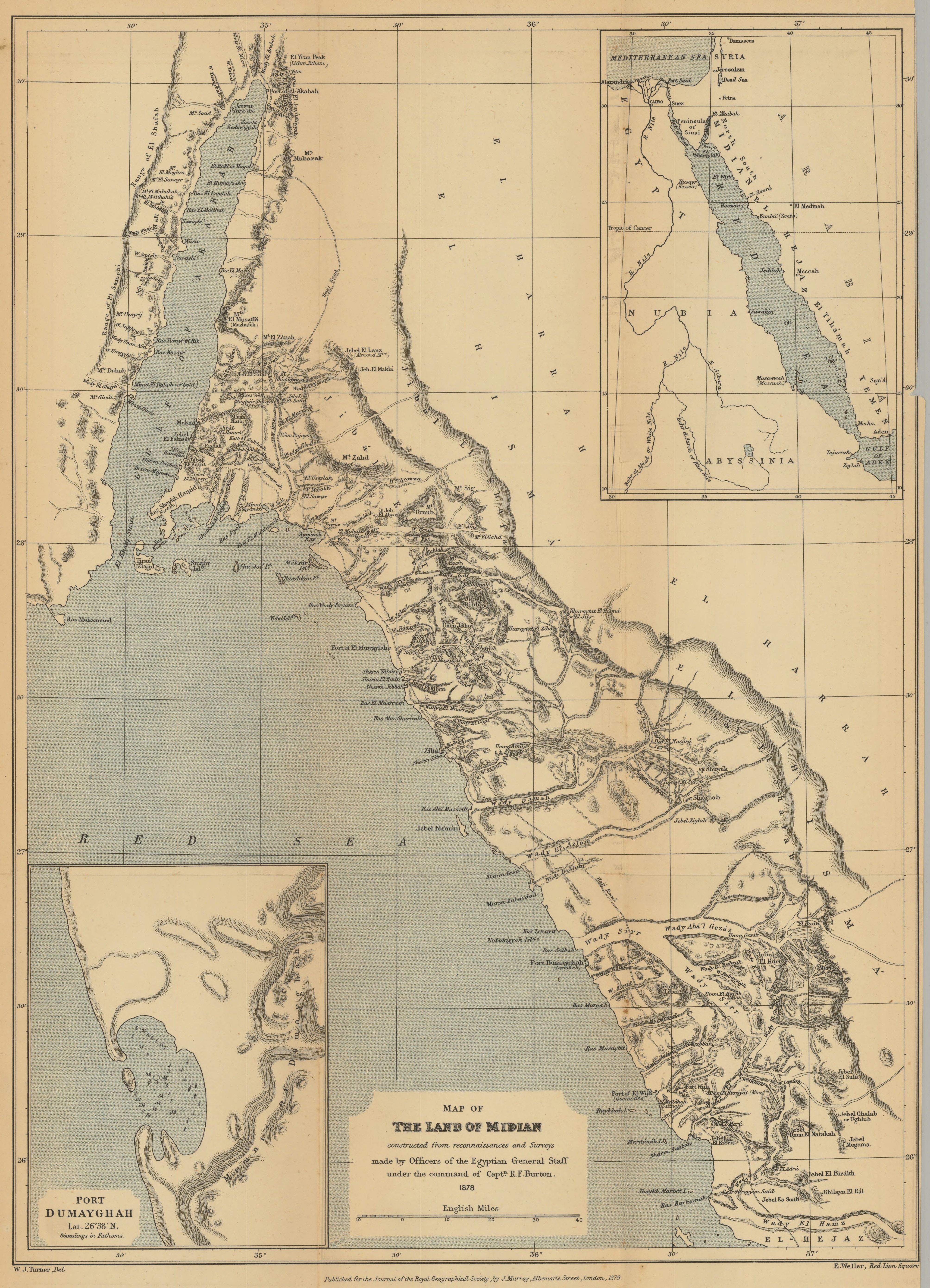
Map of the land of Midian constructed from reconnaissances and surveys made by officers of the Egyptian General Staff under the command of Captn. R. F. Burton. 1878
- Author(s):
- Turner, W. J. (William John).
- Description:
- Includes insets of Red Sea and of Port Dumayghah, Lat. 26°38' N (depth shown by soundings). Relief shown by hachures. Hajj road is shown. From: Journal of the Royal Geographical Society of London. Vol. 49 (1879), pp. 1-150; held in Firestone Library. Call number: G7 .J687 v.49 1879
- Publisher:
- London : John Murray, 1879.
- Place(s):
- Saudi Arabia
- Subject(s):
- Physical geography—Arabia—Maps, Midian (Saudi Arabia)—Maps, and Saudi Arabia—Maps
- Held by:
- Princeton
- More details at
- https://catalog.princeton.edu/catalog/7646965