
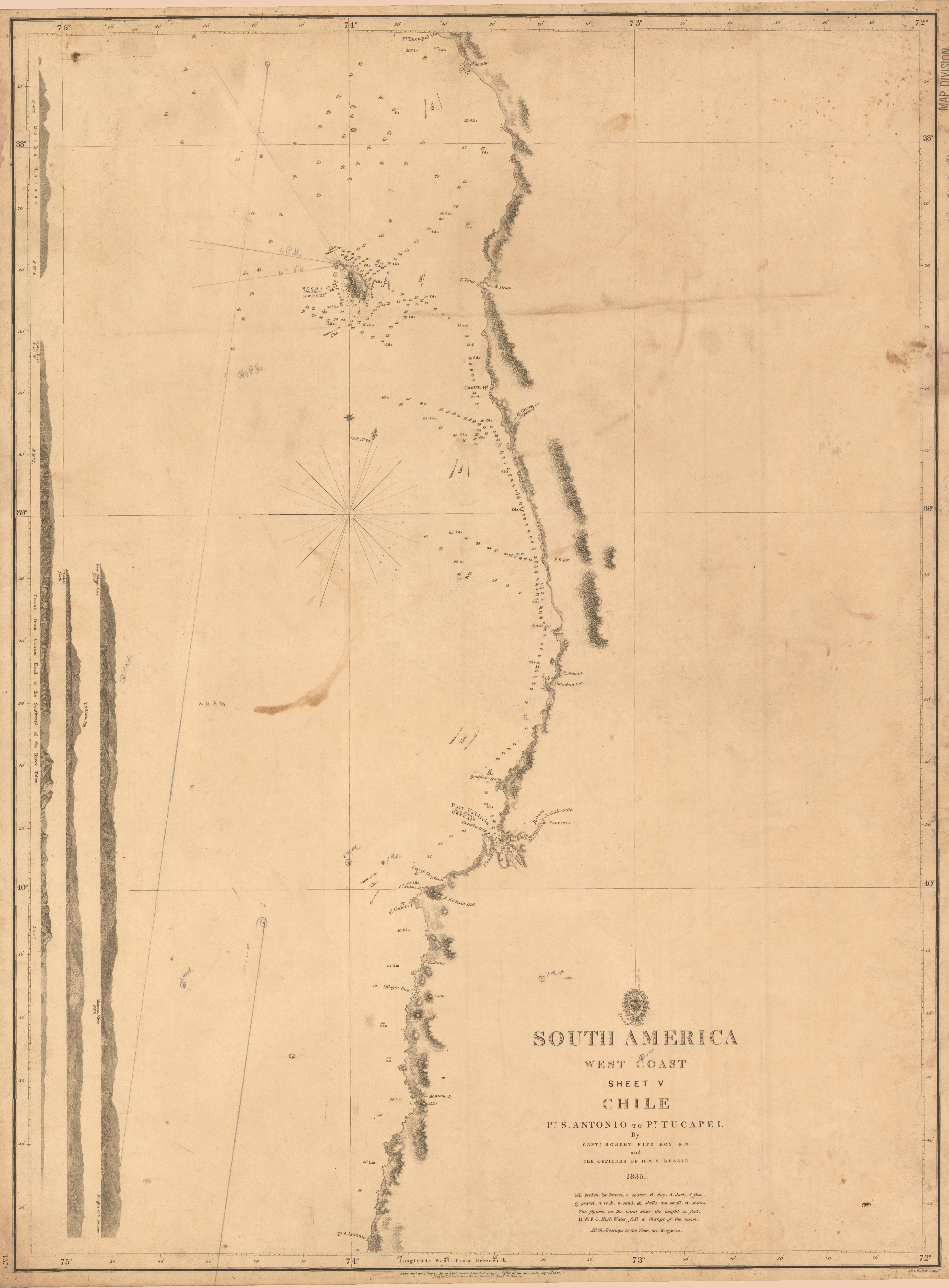
South America, west coast : sheet V, Chile : Pt. S. Antonio to Pt. Tucapel
- Author(s):
- Great Britain. Hydrographic Dept
- Description:
- Relief shown by hachures; depths shown by soundings. "Published according to Act of Parliament ... Sepr. 15th, 1840." In lower left corner: 1374. Includes 4 coastal profiles. Historic Maps copy has ms. annotations. Historic Maps copy has paper label on verso: South America. Chile--Point St. Antonio to Point Tucapel. Sheet 5. 1374.
- Publisher:
- [London] : Hydrographic Office of the Admiralty ... ; Sold by R.B. Bate, agent for the Admiralty charts ... , 1840.
- Place(s):
- Chile
- Subject(s):
- Chile—Maps and Pacific Coast (Chile)—Maps
- Held by:
- Princeton
- More details at
- https://catalog.princeton.edu/catalog/6552365