
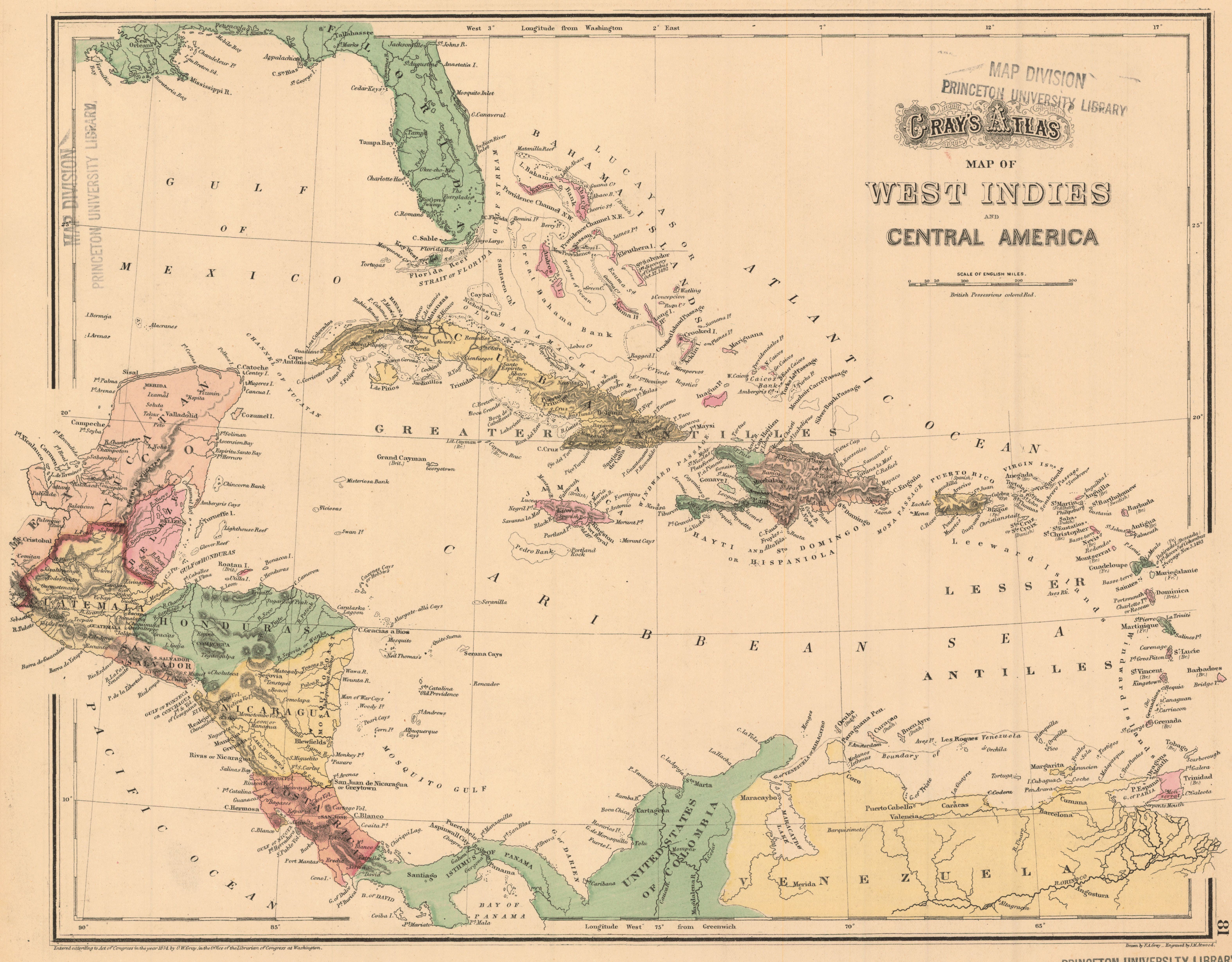
Gray’s atlas map of West Indies and Central America / drawn by Frank A. Gray ; engraved by J.M. Atwood.
- Author(s):
- Gray, Frank A.
- Description:
- Relief shown by hachures. "81-82." Inset: The isthmus of Tehuantepec. From: Gray's atlas of the United States / by O.W. Gray. Philadelphia : Stedman, Brown & Lyon, 1874.
- Publisher:
- [Philadelphia : O.W. Gray], c1874.
- Place(s):
- Mexico and Caribbean Area; Caribbean Sea
- Subject(s):
- Caribbean Area—Maps, Mexico—Maps, and West Indies—Maps
- Held by:
- Princeton
- More details at
- https://catalog.princeton.edu/catalog/6851041