
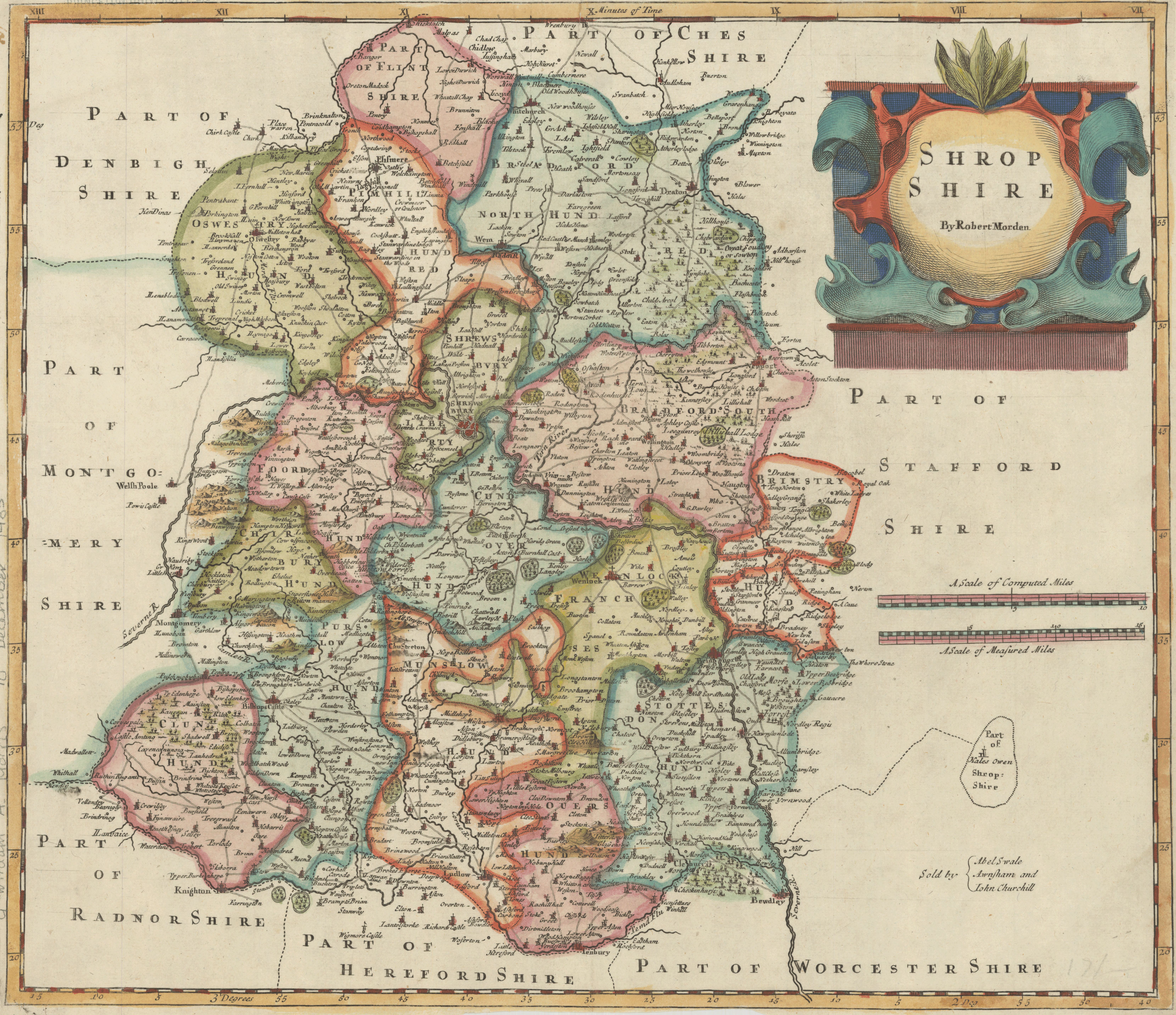
Shrop Shire
- Author(s):
- Morden, Robert, d. 1703
- Description:
- Shows boundaries, rivers, roads, woods, parks and settlements. Relief shown pictorially. London meridian. From: Camden's Britannia, newly translated into English ... [London] : Printed by F. Collins, for A. Swalle ... and A. & J. Churchil ... , 1695. First state, produced prior to changes before 1722.
- Publisher:
- [London] : Sold by Abel Swale, Awnsham and Iohn Churchill, [1695]
- Place(s):
- England
- Subject(s):
- Shropshire (England)—Maps—Early works to 1800
- Held by:
- Princeton
- More details at
- https://catalog.princeton.edu/catalog/7299993