
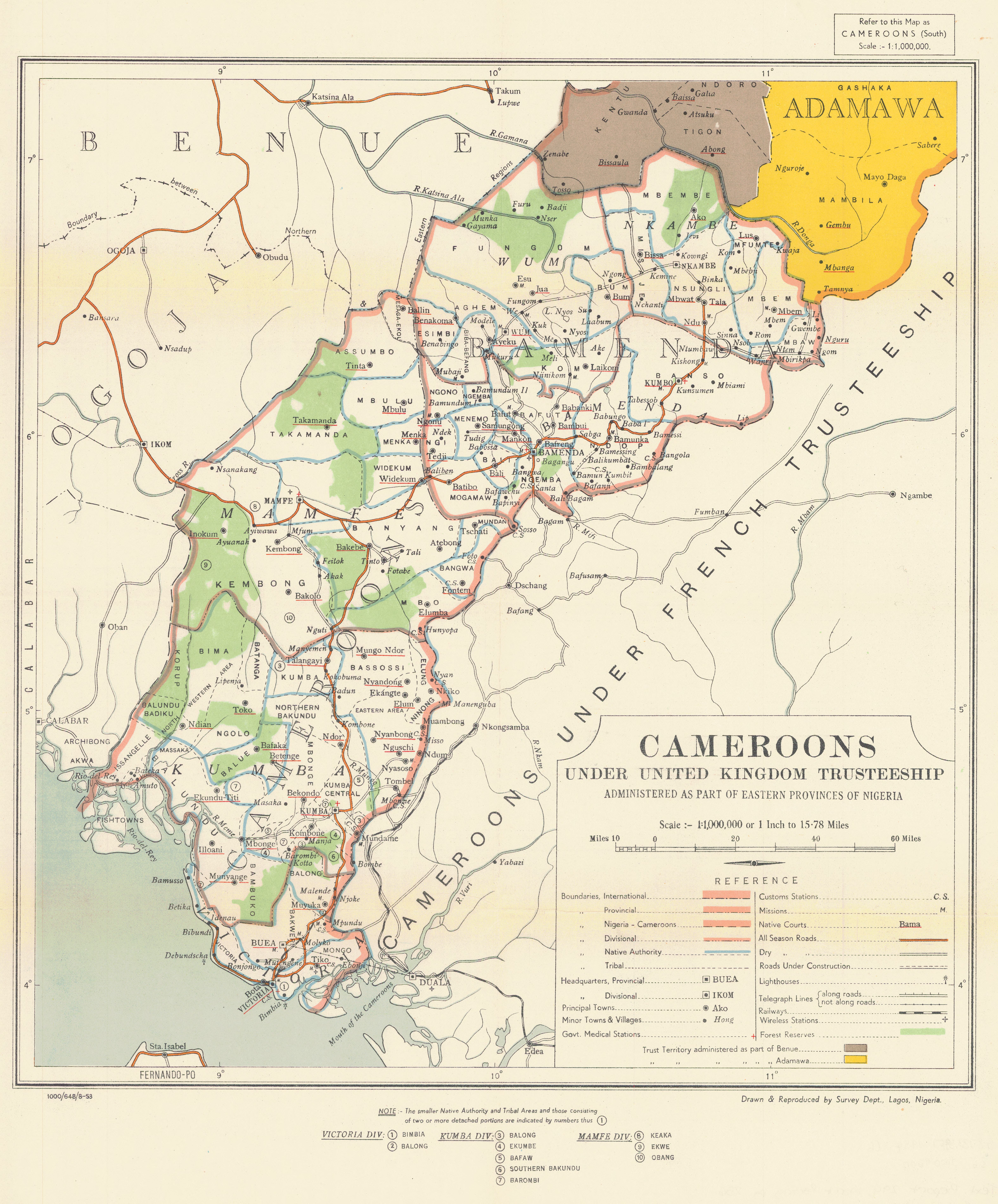
Cameroons under United Kingdom Trusteeship: administered as part of Eastern provinces of Nigeria
- Author(s):
- Nigeria. Survey Department
- Description:
- Map shows: international, provincial, Nigeria-Cameroons, divisional, native authority and tribal boundaries; lighthouses; customs stations; missions; native courts; four classes of roads; railways; telegraph lines; wireless stations; goverment medical stations; forest reserves, Trust Territory administered as part of Benue and as part of Adamawa. Native authority and tribal areas are located by number. "1000/648/8-53" Original map is filed in the Map/Geospatial Center, map reproduction is attached to companion volume.
- Publisher:
- Lagos, Nigeria : Survey Department, 1953.
- Place(s):
- Cameroon and Nigeria
- Subject(s):
- Administrative and political divisions—Maps, Cameroon—Administrative and political divisions, Nigeria—Administrative and political divisions, Great Britain—Colonies, Cameroon—Maps, Nigeria—Maps, and South-West Province (Cameroon)—Maps
- Held by:
- Princeton
- More details at
- https://catalog.princeton.edu/catalog/10009600