
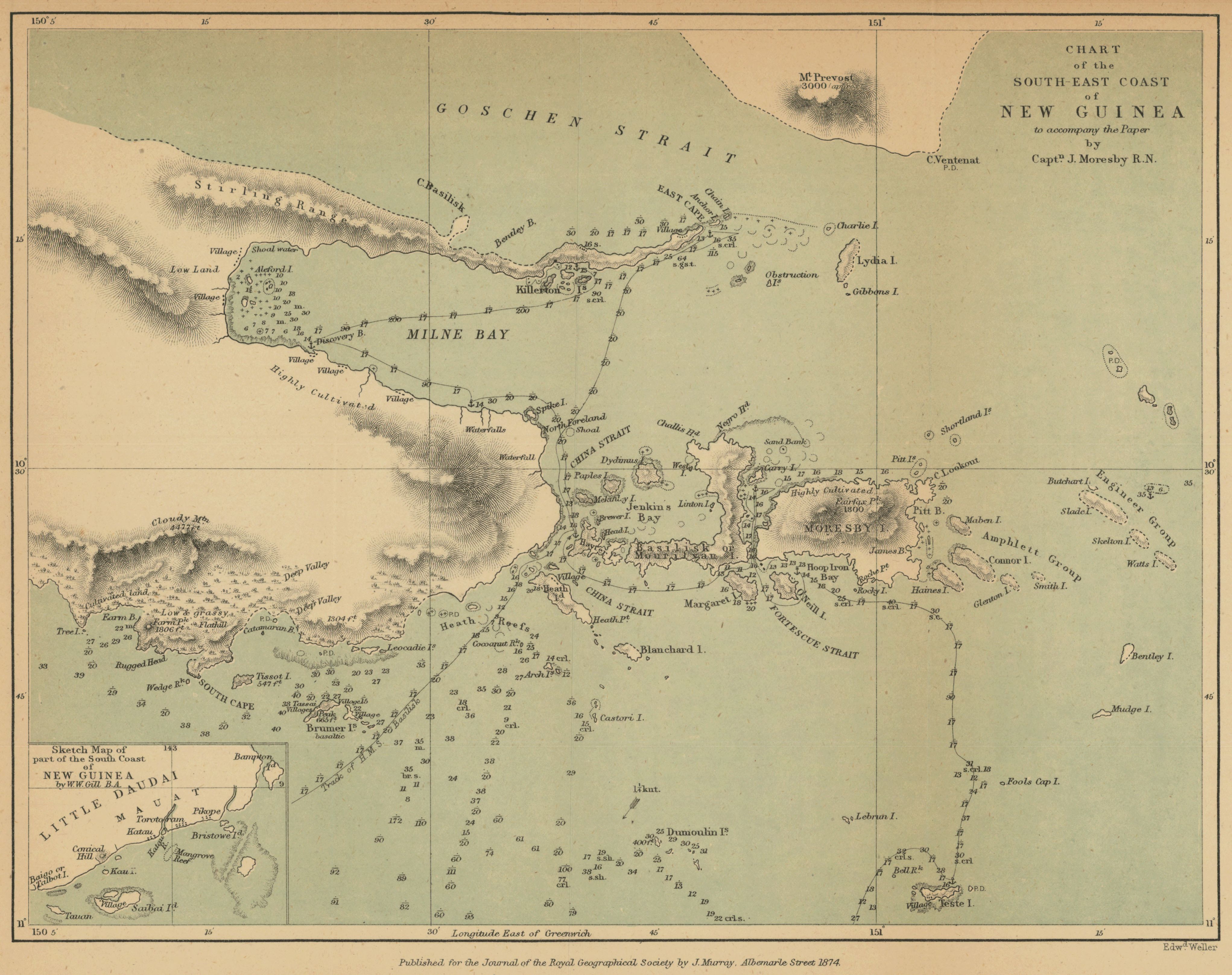
Chart of the south east coast of New Guinea to accompany the paper by Captn. J. Moresby R.N.
- Author(s):
- Moresby, John, Capt., 1830-1922
- Description:
- Relief shown by hachures and spot heights. Depth shown pictorially and by soundings (in fathoms). Track of H.M.S. Basilisk and locations of anchorages are shown. Includes inset: Sketch map of part of the south coast of New Guinea / by W. W. Gill, B.A. Shows coastal features at approx. 143° W/9° S. From: The Journal of the Royal Geographical Society of London. Vol. 44 (1874), pp. 1-37; held in Firestone Library. Call number: G7 .J687 v. 44 1874
- Publisher:
- London : John Murray, 1874.
- Place(s):
- Papua New Guinea
- Subject(s):
- Papua New Guinea—Discovery and exploration—Maps, Coastal mapping, Milne Bay (Papua New Guinea)—Maps, and Papua New Guinea—Maps
- Held by:
- Princeton
- More details at
- https://catalog.princeton.edu/catalog/7386428