
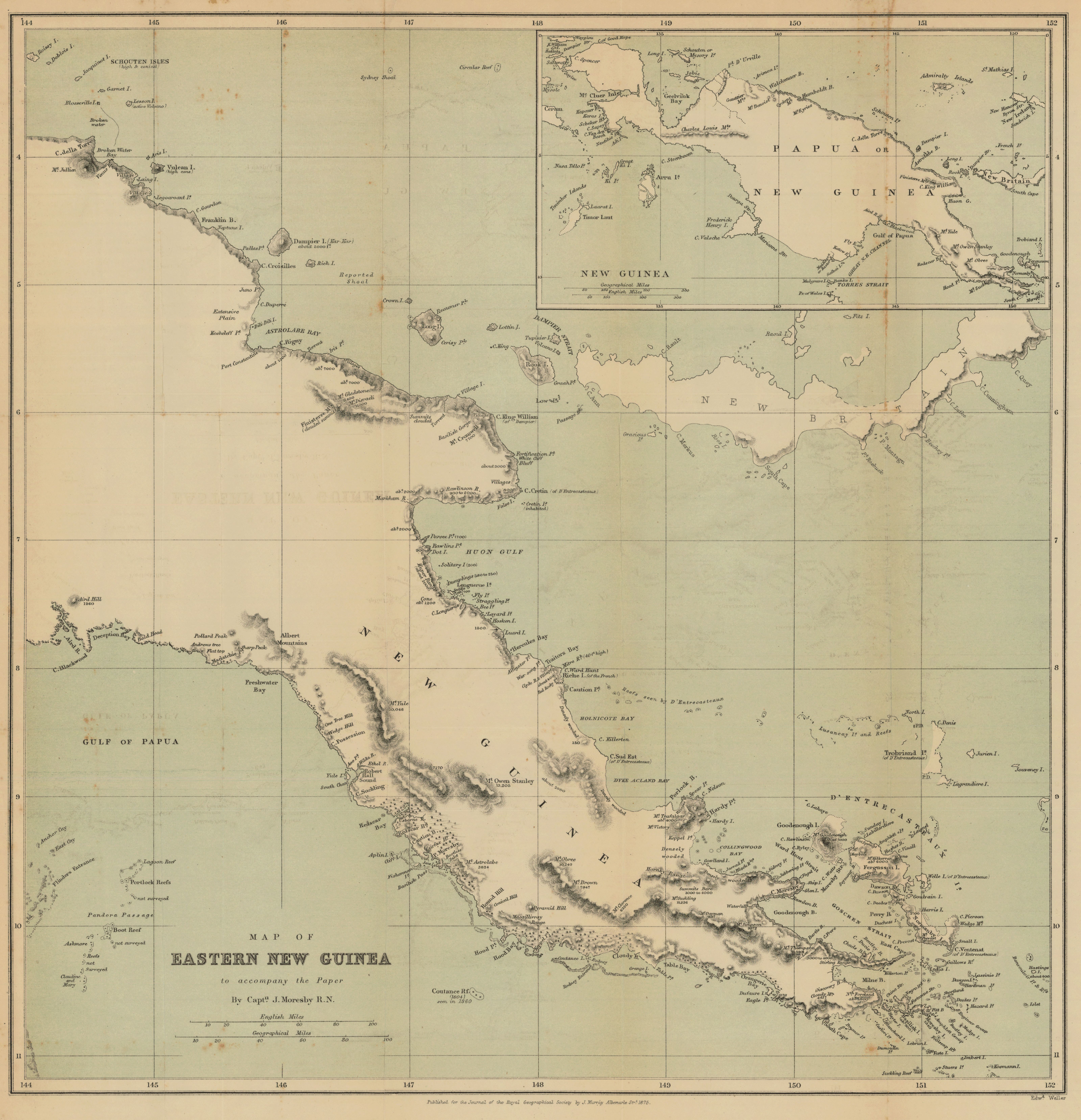
Map of Eastern New Guinea to accompany the paper by Captn. J. Moresby R.N.
- Author(s):
- Moresby, John, Capt., 1830-1922
- Description:
- Relief shown by hachures and spot heights. Reefs and shoals shown pictorially. Includes inset map of New Guinea [scale ca. 1:12,170,000]. From: Journal of the Royal Geographical Society of London. Vol. 45 (1875), p. 153-70; held in Firestone Library. Call number: G7 .J687
- Publisher:
- London : John Murray, 1875.
- Place(s):
- Papua New Guinea
- Subject(s):
- Papua New Guinea—Discovery and exploration, Coastal mapping, and Papua New Guinea—Maps
- Held by:
- Princeton
- More details at
- https://catalog.princeton.edu/catalog/7689963